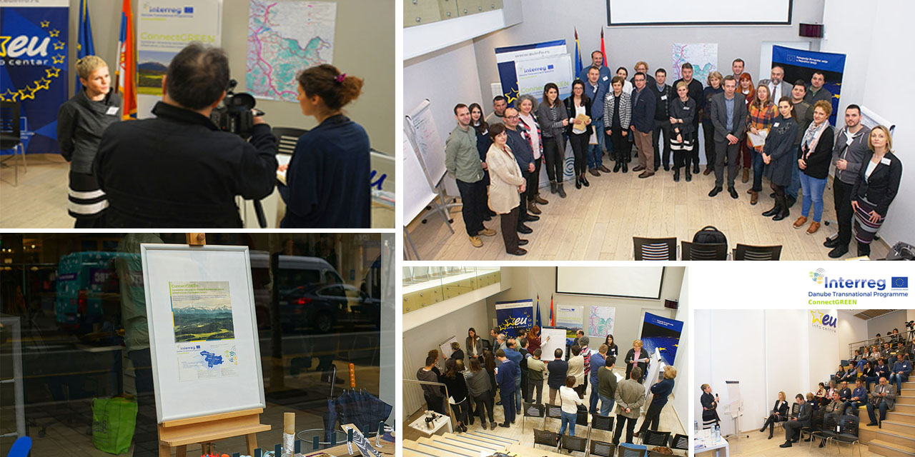
The first national workshop of the ConnectGREEN Project, dedicated to the verification of the draft of the Carpathian methodology for the identification of key areas and ecological corridors used by large mammals (carnivores), was held in Belgrade, Serbia, on February 1, 2019.
As an IPA 1 project partner engaged in the ConnectGREEN Project (DTP 072-2.3) – Restoring and managing ecological corridors in the mountains as the green infrastructure in the Danube Basin, The Institute of Architecture and Urbanism of Serbia organized the first in a series of planned national workshops to establish a framework of Carpathian methodology for identifying key areas and ecological corridors of large carnivores and designing of an integrated information system of Carpathian countries on biodiversity. [1]
The aim of the workshop was, with the participation of key actors (institutions in the field of nature protection, spatial planning, infrastructure planning and design, protected areas management, hunting, forestry, local communities, etc), to contribute to the development of specific measures for the management and restoration of migration corridors. The knowledge and experience transferred by means of active participation of stakeholders enabled a better representation of the needs of relevant sectors in defining the aforementioned methodology.
The workshop was attended by 36 representatives of relevant stakeholders in Serbia, including representatives of three Ministries of the Republic of Serbia (Ministry of Environment, Ministry of Agriculture, Forestry and Water Management, Ministry of Construction, Transport and Infrastructure and Ministry of European Integration), representatives of public companies, regional and provincial institutes and agencies (Institute for Nature Protection of Serbia, Provincial Institute for Nature Protection, Environmental Protection Agency, PE Srbijasume, PE Vojvodinašume, PE Roads of Serbia, Serbian Railways, Corridors of Serbia, PE Institute for Urbanism Vojvodina, Plovput – Directorate for Waterways, representatives of the protected area JP Djerdap National Park, representatives of the Institute (Traffic Institute CIP, Institute of Roads ad Belgrade), professors of the University of Belgrade (Faculty of Forestry and Biology), as well as representatives of other interest groups (WWF Serbia, Natural museum in Belgrade).
Olivera Radoičić, Independent Advisor of the Ministry of Construction, Transport and Infrastructure, and Dušan Ognjanović from the Sector for Protected Areas of the Ministry of Environmental Protection addressed the participants of the workshop. After Dr. Marina Nenković-Riznić, the project manager in front of the Institute presented the basic information about the ConnectGREEN Project, prof. Dr. Marija Maksin presented the Draft Methodology for the Identification of Migratory Corridors of Large Mammals in the Carpathian Region to the stakeholders. Ms. Klara Sabados, representative of the Provincial Institute for Nature Protection presented experiences and recommendations on the separation of ecological corridors in Vojvodina. The discussion on the basic elements and concepts of the proposed methodology, which completed the first, introductory part of the workshop, was followed by round tables discussions with stakeholders on the proposed draft. In the end, the project manager, Dr. Marina Nenković-Riznić, presented the conclusions on the achieved results and contributions for the future phases of the project.
[1] Based on the methodology defined through the project, ecological corridors will be identified at four transnationally relevant locations: 1. Piatra Craiului National Park / Bucegi National Park (Romania), 2. Apuseni Mountains / Southwest, Carpathians (Romania) / Djerdap National Park (Serbia), 3. Western Carpathians (Czech Republic – Slovakia) and 4. Bükk National Park (Hungary) / Cerová vrchovina Protected Area (Slovakia). Physical barriers and other threats at these locations will be identified and integrated together with other categories of spatial data into the integrated information system of the Carpathian countries on biodiversity (CCIBIS).